Thursday, December 01, 2005

Safe in Their Beds...

John is nestled in the down comforter, sleeping soundly in the basement cocoon of the house. I'm upstairs, sleepless, with my favorite blanket wrapped around my shoulders and the computer giving off a dull glow in the dark. And here we are: home.

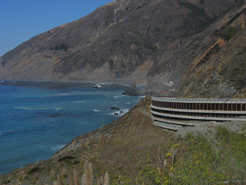
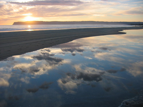
We arrived a few days ago, just in time for a belated Thanksgiving with my family. We spent Thanksgiving proper with John's family in a rented house on the ocean in the Outer Banks. It was blustery, cold, and salty -- perfect for looking out the window and thinking fondly of the beach. We have spent the last few days hiding out, digging down, trying to staunch the vertigo from sudden inertia. The moment we arrived here, we were both hit with a tidal wave of exhaustion that I think we weren't expecting. After all, the final two weeks of the trip were practically motionless; quiet and relaxed. A pre-hibernation to foreshadow the little dent we make in the earth now.

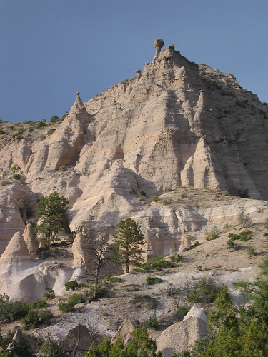
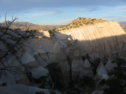
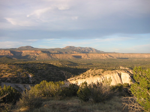
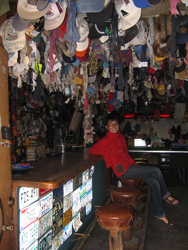
We left the hustle-bustle of Nashville and headed to Asheville, where some friends of a friend of a friend graciously took us into their home just as the temperature in the mountains plummeted to "unbearable in a three-season tent." We met them at a Blackalicious show at the Orange Peel, the liveliest venue in the country as far as we can tell. Can the hippies ever dance. Alisha and Nicki, the aforementioned friends, led us back to their house and as quickly as that we had nearly moved in. We stayed four days, and were not easily convinced to leave. They are raising an amazing kid by the name of Elliot. He had the croup, so we got to play hookey with him. Mostly, this meant playing the Harry Potter board game, Slapjack, War, and Go Fish, and watching cartoons with the cats -- Lover and Gooey. We made chicken soup and drank tea all day. Wintery perfection. Our major excitement was finally snagging Chaco, who appeared in trap (empty of any treats, the poor curious creature) on day two. We walked him down to the creek with Elliot and set him free to become part of the food chain. Elliot was pretty impressed that he had come all the way from New Mexico. And come to think of it, so were we.

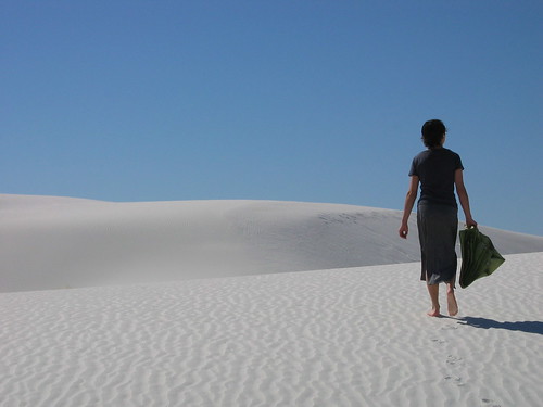
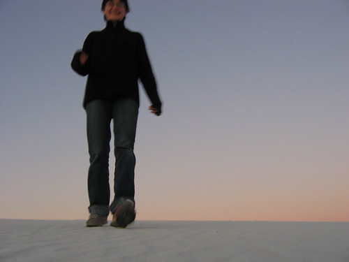
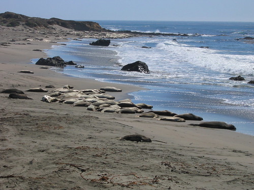
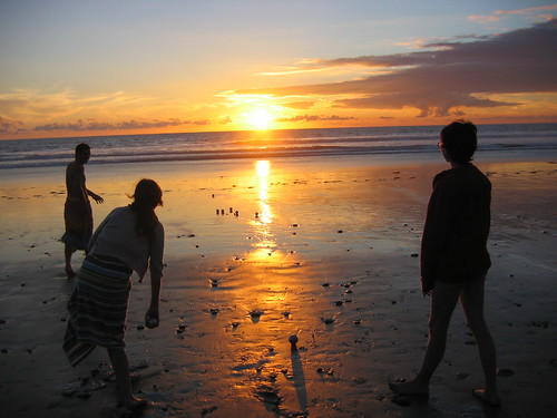
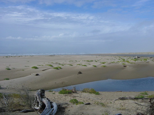
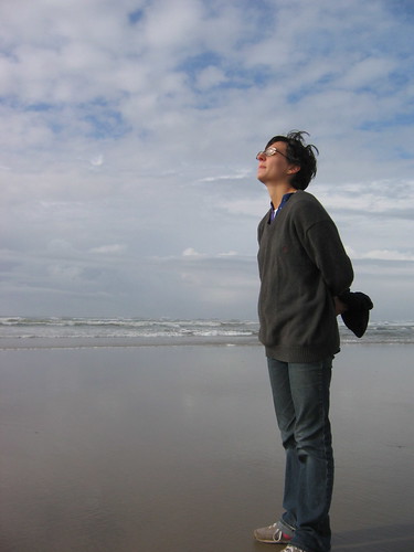
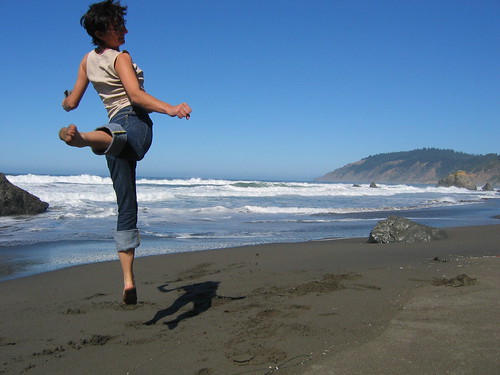
Asheville gave way to Duck. The hibernation deepened. John's family is tender, quiet, and introspective. The major excitements at the beach are the daily trip to the grocery store and making dinner, and neither shake you very deeply from your deserved recline. Occassionally Sunny Boy, the family motivator and a yellow lab, would demand a trip to the shore to chase birds and strut about with horseshoe crabs dangling from his lips. We ate salmon and clams and shrimp for Thanksgiving, and gave our thanks for each other and the safe harbor of family.

Driving into DC for the first time in five months brought about the frame shift that happens to all travellers -- the sudden sense that you were just here, perhaps even yesterday, and everything is as it was. And in the next instant, you are suddenly just as sure that a lifetime has passed, and you can't summon the feat of imagination that will label this place home. There's no way to sum up the trip without pretending it was simpler than it was for both of us. I think we both found a kind of happiness we hadn't previously had, and we're eager to hold on to it. Certainly, we can offer our thanks to everyone for following along, encouraging us, sharing your homes and beds, and perhaps also for allowing yourselves to be a little inspired.

We'll be in DC through January. After that ... we'll keep you posted.


IMG_2895

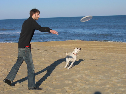
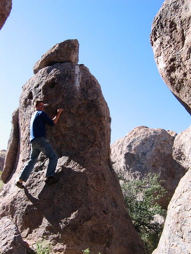
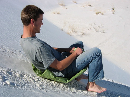
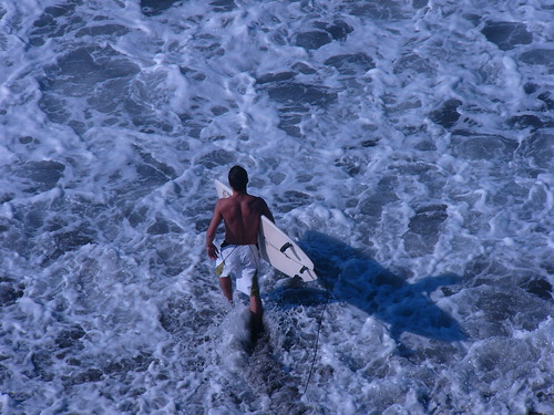
Sunny and Stephen (John's brother), breaking a sweat


IMG_2899

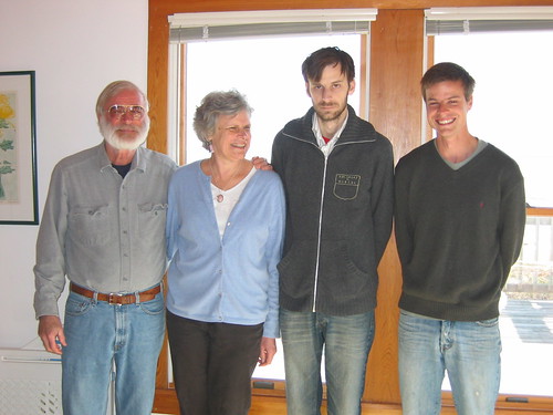
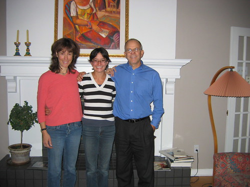
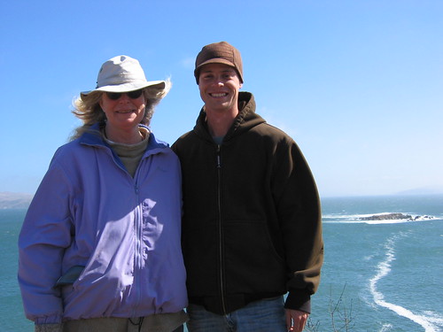
The Mayer Clan (from left: Dad Gerry, Mom Nan, Brother Stephen, and Man I Love)


IMG_2868

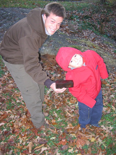
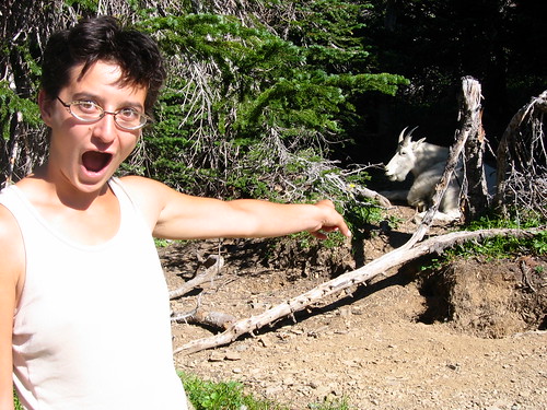
"If I love Chaco, can I keep him?"

Tuesday, November 15, 2005

That good ol' mountain dew

As you might imagine, it's difficult to find the internet in Arkansas. In fact, it's difficult to find a gas station that will take a credit card. Apologies, then, for being remiss in updating.

After leaving Albuquerque, we headed north to Santa Fe -- a lovely, if very touristy, town. It made it to the list of possible places to move after this is all over with, mostly because of excellent food and incredible mountains (a feature we weren't really expecting in New Mexico, but the state turns out to be full of surprises). We headed to Taos and the Sangre de Christos mountains, north of Santa Fe after two days in the nation's highest capitol city. In Taos, we found a beautiful antique map of North America from 1877, which we picked up as a souvenier of the trip. We did some hiking up in the mountains (where the altitude really whipped us). It had already snowed up there, and at night was getting down to about 10-15 degrees -- we had to sleep huddled under our two sleeping bags and the down comforter, and were still freezing most of the night. We had to be in our tent by dark (around 5 pm), otherwise it got too cold to function. But it was cozy and wintry, and we upped our nightly sleep allotment to about 14 hours.

From there, we headed west to Chaco Canyon -- an area where one of the major civilizations of the southwest was rooted. There we visted Pueblo Bonito, the largest building in the U.S. before the advent of structural steel -- 600 rooms, 4 or 5 floors high, elaborate masonry -- and built between 850 and 1150 A.D. It was *amazing* -- even more so because you can walk through all the rooms and sort of pretend like you're discovering it for the first time. A friendly ranger, obsessed with the astro-archeological events that the Chacoans constructed in the canyon (they think, anyway -- things like shafts of light that shine in patterns around the equinoxes), took us up to watch one of these events at sunrise. We were standing on 1000 year old walls, on the third floor of the ancient building ... it was pretty amazing.

Here we also met a new friend, whom we picked up in the desert. Strangely enough, his name is Chaco. He's been with us for over a week now, and eats insufferable amounts of our food, though he hasn't figured out the food box yet. The third morning with us, we woke to find that he had stockpiled our "fancy nut" mix in John's left shoe. After that we bought the mouse traps. We caught him yesterday for the first time, and he's got the cutest little mexican mustache that points straight out to the sides. But it was raining, and we let him go right next to the car, and we woke up this morning to find that he must have run straight back in -- the Doritos had been raided.

So, with Chaco in tow, we headed north and east into the mountains of Southern Colorado. There, we visited the Great Sand Dunes -- the highest dunes in North America. We climbed a 650 foot dune (which was probably the most difficult hike we've done). It was worth it for the 360 degree views of the dune field, the 14,000 foot mountains next to us, and the endless valley stretching south into New Mexico. We ran down the slipfaces of the dunes, which were incredibly steep and incredibly fun to descend -- the sand makes a sucking noise as your legs slip in up to your calves, and avalanches of sand run down the face from each footprint -- and each step carries you five or six feet down the slope.

Then began our rapid trip across the Texas panhandle (the worst smelling state so far -- cow shit and gas pumps, echgr) and Okalahoma (where we went to our first WalMart ever in Carrie Underwood's hometown). We angled for the Ozarks. In some of the more rural drives we've done (*seriously* Deliverance country), we passed huge encampments of hunters (it's elk and deer season) in the mountains there. We passed a local restaurant actually advertising Fried Catfish and Froglegs for lunch. And they have the crookedest roads you've ever seen -- there's not a straight road in the whole state. Our second night in the backwoods, we found the Ozark Folk Center, which happened to be hosting the final festival of the season -- bluegrass. It turned out to be an excellent show of five groups from all over the south, but one of the strangest experiences of the trip. The audience was uniformly ancient. And -- totally surprising for a bluegrass show -- unequivocally silent. There had been a lot of pre-show requests for gospel (every band mentioned this and played at least half their set as gospel), and the only enthusiam the crowd showed was for the men to reach up and pull off their hats for the gospel songs. Polite clapping and the removal of hats. It was either the most discriminating crowd I've ever been a part of, or the most repressed. I thought it was pretty good bluegrass, but maybe my standards are too loose...

Anyway, here we are in Music City. Nashville. Tennessee. The weather is shit -- that good old east coast November rain. Our trip ends in less than a week. We're in denial about that, but beginning to look forward to what's next -- turkey, mostly. And even thinking a little more seriously about where we'll be moving, and how to move, and when to move, and ... There's a lot of unanswereds. One thing we're pretty sure about is that we'll miss this way of life -- sleeping out, sleeping long, never seeing the same thing twice in a day. We've come up with some easy coping mechanisms -- making pancakes on the propane stove, camping in the back yard, sitting in the car on Sunday afternoons to listen to This American Life.

Quick warning for those on the east coast: we plan on having a party when we get back. Not sure where or when, exactly. We're looking forward to seeing everyone -- we're having a lot of pangs of missing folks. Oh, and we'll be back in DC the day after Thanksgiving (although that weekend will mostly be family time). Best, J and H.

Wednesday, November 02, 2005

Born again

After leaving Sedona, we camped for the night in a ponderosa pine forest by the name of Tonto. Ponderosa forests smell spicy like any other pine groves, but if you sidle up close and breathe in deeply, the bark smells sweetly of vanilla.
The next day, we crossed into the state where I was born. New Mexico surprised us from the outset. We entered from the west into the vast expanses of Gila National Forest, as seen below.

IMG_2518


We quickly reaped further rewards after spotting signs for the San Francisco Hot Springs. We pulled off onto a dirt road and found, instead of the hot springs we expected, a trailhead. A quick calculation indicated that the 1.5 mile hike to the springs was possible before the sun set (around 5pm now), and off we went. We followed a rudimentary map through cactus-filled hills, down into a river canyon. After some misadventure and directions from a local, we found three small shallow resevoirs created by rock dams. The springs were sitting just alongside the river, each progressively warmer. We were alone in the late afternoon, and we able to take baths in the river after a good soak. Here's John lounging in one of the pools, the river just beyond the rocks.

IMG_2527


We camped at the trailhead that night and were treated to the most incredible show of stars yet. We even left the rain fly off to better appreciate the view, although the temperature dipped near freezing that night (the fly holds in a lot of heat and makes camping in the cold a lot more manageable). We met a crazy lady from Colorado, who was so lonely she couldn't bear not to speak for about two hours straight. But she fed us homemade banana bread and yummy Colorado apples, so we liked her just fine. Next day, we headed south and east, stopping at a state park called City of Rocks. Here, in the middle of the desert, an outcropping of rocks rises up smoothed into alien shapes that resemble some impossible ancient city. John scrambled up some of them.

IMG_2547


Later that afternoon -- an uncelebrated Halloween -- we arrived in south central New Mexico at one of our most anticiapted destinations, the White Sands desert. The desert sits in the middle of the White Sands Missile Range, where the first atomic bomb was detonated, and adjacent to an Air Force base and numerous other places where scary things happen. We were treated to a viewing of the Stealth fighter jet, and the next morning we received an 8 AM wake-up call from one of the missiles they were exploding on the range (from 30 miles away it sounded like it was happening under the tent). To say the least, it was a strange place, no less so because of what we were there to see -- the snow white dunes of the gypsum desert.

IMG_2630


It looks exactly like snow, and like snow drifts, the dunes here can move remarkably fast -- up to 30 feet in a year. They move so fast that most life can't survive. We went for a ranger-guided walk at sunset and learned a lot about the unique ways that life forms have adapted -- including, incredibly, some cottonwood trees (which are normally found along rivers with abundant and constant water sources). They don't know for sure how the trees stay alive, but hypothesize that the trees are able to collect fresh rainwater in pools just above the alkaline watertable, which the roots can draw from in dry spells. The desert gets 8 inches of rain a year.

Another unique life form is this plant, which collects water from the sand (the sand acts as a sort of sponge for water) around it's roots, which then hardens and crystalizes the gypsum. It's able to create pedestals, which hold the sand in place even as the dunes move around them. Inside the pedestals, the temperature is a constant 77 degrees, through the 110+ degree summers and winters that cool to below freezing temperatures. The desert's animals--including mice, owls, and foxes--mostly live in these monoliths.

IMG_2608


It's hard to resist taking a few glamour shots in a place like this.

IMG_2634

IMG_2623


It's also hard to resist having a little fun. We grabbed a tarp from the truck for a little sledding.

IMG_2644


The next day we decided to drive to Albuquerque, where I was born, to meet my godparents before they left for a trip to Europe. I hadn't seen them since I was a toddler, when they and my parents were very close friends. John, my godfather, did his residency with my father, and Mary Ann and my mom were constant companions. They were there for both mine and my brother's births. We an excellent, if hurried, visit and got to learn a bit about how my young parents lived their lives.

IMG_2696


We spent some time today driving along the old Rt. 66, which stretches through the southern part of the city as Central Avenue. It's lined with old motels possessing decadent vintage neon signs. We also sported through old town, the original settlement of Albuquerque, founded in 1706 (celebrating it's tricentennial next year!). It's full of tourist shops now, including some high-end galleries that have incredible Native artifacts -- pottery, rugs, baskets, etc. Since we'll be visiting some of the pueblos later this week, we refrained from spending any money. In the afternoon, we met up with Matt, and old friend of Johns' from DC, who took us on an incredible hike at Tent Rocks, about 1/2 hour north of town.

IMG_2698

We had to almost run to the top in order to get out of the park by closing time at 5, so we did the 1.3 mile ascent in about 20 mintues. We hiked through the weird formations you see in the pictures, to this view at the top.

IMG_2703


This is looking out over the Jemez mountains from the top. You'd almost never know that both Albuquerque and Santa Fe are both within about 30 miles of here.

IMG_2705

Saturday, October 29, 2005

We're almost caught up...

Here's some photos from the last two weeks -- San Francisco, Monterey, none from LA unfortunately, and San Diego. Next post: the sun sets behind us.

Here we are in San Francisco (the Golden Gate bridge is actually behind us, but since no one was around to take our picture we had to do that annoying couple thing where we hold the camera ourselves -- forgive us)
IMG_2198

This is a photograph of a Hanspree "lifestyle television" at their U.S. flagship store, which just opened in San Francisco. Although addicited to TV, I secretly hate it. This company is fast becoming my nemesis, as it makes me want desperately to own one of everything it makes -- included stuffed animal TVs. The woman at the store was quick to point out that their TVs are NOT marketed to kids, but instead to adults who want an "emotional connection" with their electronics. That would explain the Cinderella TV on a foot-high pedestal that only infants can see standing up.
IMG_2197

At the world famous Monterey Aquarium -- jellyfish
IMG_2209

Hanna tries to call up one from the deep in the Shark Myths exhibit at the aquarium
IMG_2212

Foggy sunset, Big Sur
IMG_2228

Route 1 makes you sick
IMG_2241

Elephant seals! (They look dead, but they're actually tanning.)
IMG_2242

Sunset at the Coronado Hotel's beach, where we celebrated our 4 month anniversary of the trip with pricey scotch
IMG_2282

Hanna chatting with a statue at the San Diego museum of something or other
IMG_2274

Playing Bacci at sunset (Hanna, brother Pete, and Pete's gal Toni). We went camping--our first time with other people!--on the beach just up the coast from San Diego.
IMG_2293

Pete goes surfing in the morning. We watch from the cliffs.
P1010695

Thursday, October 20, 2005

Backtrack

For the first time in four months I recognize a vaguely remembered feeling: boredom. Insidious beast. John and I celebrated the four-month anniversary of the trip with a glass of expensive scotch at the Coronado Hotel here in San Diego two days ago. Today, he left for Charlottesville, and here I am, alone in my brother’s apartment, clocking in 10 hours on the computer looking at job listings, hotel listings (Vegas, baby), blog listings, and finally, The OC episode guide. It’s a cheap throwback to working in a cube eight endless hours of the day. Being stationary for so long (six days now, and five more to go until John flies back here to me) has created a drag effect. Which isn’t to say we haven’t had a wonderful time in SD, but … well, being in one place for a week is reminding me that we’ll soon be back in DC, for an unknown number of weeks. The trip is officially only 4/5 over, but in our mental landscape of America, it’s a lot closer to the finish. Perhaps you see more than you’re capable of taking in, so you stop taking things in. Perhaps I’m just a bit melancholy. Or perhaps, realistically, we’re just shifting back into the necessary headspace to end this thing. In any case, some combination of factors (nasty hangovers included) left me without the energy and curiosity that have been the hallmarks of daily existence on our journey. Time to give myself a kick in the pants. We begin with some overdue photos, if our dallying hasn’t lost us all our readers altogether.


IMG_1976
Here’s s my mom picking grapes in Grandpa Dixon’s garden in Spokane – soon to be jelly


IMG_2000
Here we are making apple cider on the antique cider press with Aunt Heidi and Uncle Stacey’s grapes and apples


IMG_2043
Between Spokane and Portland, we drove west along the Columbia River (it more or less forms a border between Washington and Oregon), stopping in Columbia Hills State Park on the WA side to camp one windy night. This photo gives a good sense of the high desert climate of eastern and central WA (betcha didn’t know it looked like this in the Pacific NW). It’s sweepingly gorgeous, and a little daunting.


IMG_2062
After Portland (where we stupidly didn’t take any pictures), we made our way to the coast and began our descent along the Pacific. Here are the Oregon dunes, some of which reach up to 400 feet high, grabbing at the ocean.


IMG_2071
After hiking through subtropical rainforest and climbing over the expansive dunes, we came to this beach (see below). It was littered with disembodies jellyfish, like little gooey eyeballs.

IMG_2069
The beach is so flat here that the water creeps up the sand for hundreds of feet beyond where thes wave break.


IMG_2089
Lumberjack John in the redwoods (under Paul Bunyan’s left foot). Now we're in California.


IMG_2096
This is a very big tree (over 20 ft. in diameter and formerly 368 ft. high – the top fell off a few years ago and now it’s something like 250 ft.)


IMG_2091
These trees are about 300 ft. tall


IMG_2146
Spotlight on Brinkman


IMG_2149
Sexy Beast #2


IMG_2173
Here I am trying to relive the successes of my youth. This is the beach just past where Route 1 first meets the ocean, and where we met Dusty Miles. John’s a pretty ace shot, eh?


IMG_2188
Here are John and his aunt Pat, extended family member #1!


IMG_2191
John and Pat on the cliffs over the ocean

Next up: San Francisco, LA, and San Diego.

Thursday, October 06, 2005

California California California (sung to the tune of the OC theme song)

Those of you who know me well will not be surprised to learn that I left my laptop on a counter in a Kinko's in Salem, OR. Happily, FedEx and Kinko's are now one, so they are mailing the cursed thing to my brother in San Diego, where we plan to arrive a week or so from now. Until then, no photos. Which is a crying shame, because we have some good ones from the Oregon coast, including sundry sequois sempervirens (the coastal redwood behemoths), as well as northern California. Sans photographs, here is a picture in words of our most recent adventures:

We left Salem and headed for Albany where my great-grandmother's farm is (though it now belongs to one of my father's cousins). My father and his various siblings and cousins more or less grew up on the farm, spending every summer of their young and adolescent lives there. I had also been there many times when Nanny was still alive, and recall that it's most prominent feature was the spider-ravaged fruit cellar where you were locked if you misbehaved. My father bought the farm from Nanny before he died and intended, I think, to live out his days there. Being as such the place where I could possibly have spent my own young and adolescent summers (and winters and the rest of many years), it's an interesting excercise in the many worlds theory to return and see what my possible life would have looked like. My grandmother's sister June lives down the gravel way, and we camped on her lawn (the gang was out elk hunting, so we had the place to ourselves) and listned to the owls cry dusk and watched the sun set over the stalwart row of redwoods that break the wind off the fields. All in all, a possible childhood to relish.

We decamped from Albany on Sunday and aimed for the coast of Oregon, 60 miles to the west. You may have heard it from other, more reliable, sources but the Oregon coast is the most beautiful in America. Foresight left the vast majority of it in state hands, and the rest--due to strict zoning and building laws--is hardly developed (a far cry from the misery of the Atlantic coastline). It's misty, foggy, craggy, and fearsome. We stopped for a hike out to the Oregon Dunes, which reach heights of up to 400 feet and feature the complex and delicate growth of hardly coastal grasses. We ran from "sneaker waves" -- one in every few hundred that race past the tide line and steal inattentive creatures out to sea. Just inland of the dunes is a strip of subtropical rainforest, in which John spotted lots of slithery things. The hike was beautiful, emerging as you do from one of the rarest microclimates in the world--where the thick canopy of the forest chokes out the sun--into the bright, open world of sprawling sand beasts and gnarly ocean.

We started the working week off with our arrival in the redwoods. The story of the preservation of the redwoods forests is unique, and easily discovered by a trip to see the giants, which we encourage. Loads of very good writers have described being among the redwoods and feeling a religiousity descend on them, and indeed being among them was like being a cathedral. But we felt that the most apt approximation of their character and stature was captured by Peter Jackson in the Lord of the Rings movie (I'm not a Tolkein geek, so I don't remember the names of the giant tree guys who come to the rescue of the wizard, but you know who I mean). Some of the trees are more than a thousand years old (some almost two thousand), and are the tallest living things on earth (taller than the Statue of Liberty, though not living is a good marker of the height of these behemoths). The oldest came to exist around the time Christ was born, before Shakespere, before Columbus, before Napoleon, and long before us, and they have stood through earthquake, flood, fire, and gale. Walking through the forest and looking up, it feels like the sky has receded many miles higher than it was the last time you checked. They are beings that extinguish human egotism and embellish the goodly human insticts--like reverence and wonder--at the same time. We set up our camp just next to a stream in Elk Prarie State Park, back in a dark, damp corner of the forest that never sees enough sunlight to dry out.

The next day we thought we'd take a four-mile hike through the forest to the ocean and the "gold bluffs" that sheer up out of the water. At the beach we saw a herd of elk, a magnificent male among them, his antlers in relief against the ocean, feeding on the coastal grasses. Our hike then turned epic as we opted for a longer route home, and fourteen miles later we were back at camp, tired and sore and sorry indeed, but ready to enjoy a fire and a jug of good Oregon beer we picked up in Hood River at the Horsefeathers Brewhouse.

We slept through the dampness only to find that it had gotten to Brinkman in a bad way. When we piled in to leave, we found that his poor engine was flooding every time we turned the key. We spent an hour or more, with input from various passersby, tinkering and trying to figure out what was wrong. Just as we were about to give up and call AAA, John gave him an abusive crank and he sparked to life. We surmise that the condensation from the damp forest (and no sunlight to evaporate the moisture) just soaked the engine through. In any case, we were off.

We followed the coast down to California passing through more redwood territory until we came to Highway 1, the infamous deathtrap that people with sportscars like to call "scenic." In fact it's both scenic and dastardly, with tight endless switchbacks tailored more to German engineering than Japanese. Brinkman--a brutish rather than a fancy creature--set himself to the challenge heroically and didn't once carry us over a cliff. The first 25 miles of the road takes you over the Coastal Range to the ocean, and passes through what people have variously described to us as "straight hillbilly country," "Mexican mafia bandejo land, man," and "where they grow all the marijuana." Intensely wooded, with little more than KEEP OUT signs to indicate a human presence, it didn't feel like a place you'd want to contract engine troubles. Perhaps the most forebidding of all were the few broke-down shacks we did see--replete with decaying, moss-covered roofs and collapsing foundations--in which people were actually living. Eventually, though, the road shoots you straight out of Deliverance hell and onto the ocean cliffs, which it follows on a knife edge down to San Francisco, 150 miles to the south.

We camped at the first place we came to, the cheapest state beach in California (at $10 a night), according to a fellow we judged to be knowledgeable since he lived in his van. It was perhaps also the friendliest. We parked about 25 feet from the edge of a cliff, looking out over uncountable billions of gallons of ocean, and set up our tent as close as we could to the chasm (that turned out to be about four feet). Within minutes, an older couple from San Jose had befriended me (John was fetching firewood). They were two months on the road and sweet as pie. When John didn't return soon, I left them and went to fetch him and his load. Enroute back, we were flagged down by the man who lived in his van, who needed a jump start because his car battery was an egg (to hear him tell it, but it seems more likely to us that it kept dying because he was running a heater, radio, and DVD player off of it, and hadn't moved the car in a few days). He offered us a beer for the help ("Don't run off now"), and we sat with him and his dog and watched the stars light up, and then the moon set, and then Mars. "Dusty Miles" is how he introduced himself, and his dog was Roscoe Resin. He moved between the coast and the desert, selling jewelry he had taught himself to make, and seemed pleased with his current state of affairs. He told us he used to "dream about doing bad things to people who'd hurt me and shit, but now I dream about jewelry, man." And concluded, "This stuff heals your soul." Despite the fact (or perhaps because of it?) that he'd clearly spent a lifetime smoking pot, he was intesely friendly and we greatly enjoyed his company. By the time we got back to the camp, the old folks from San Jose had worked themselves into a worry over where we'd dissapeared to for so long ("Jumping Joseph and Mary, you kids nearly drove us to drink!"). We visited for a long time the next morning, and offered them a can of our salsa to smooth things out.

After playing on the beach for a half hour, only to be disturbed away by the corpse of a dead sea lion, we headed back to Rt. 1 for a few hours drive to Bodega Bay to visit John's Aunt Pat. And after a few pit stops to let our churning stomachs settle and take in the equally amazing scenery, we made it to Pat's bungalow on the beech where we now rest and relax. We have enjoyed lots of talk of animals and the universe's harmony that we are indeed feeling everyday and John is relishing the opportunity to really get to know more of his family . You might notice that this is the first that we have seen of John's family and that has nothing to do with not loving those that are out there but rather from the fact that he comes from a family quite the opposite as Hanna. John has one aunt and one uncle, a close nit immediate family and no cousins or grandparents. Inspired by Hanna's love and closeness with her family has inspired John to seek out more fully those of the clan that are still around. We are enjoying day two of our visit to Bodega Bay and will head on Saturday for the Bay Area and then onto points south. Pictures will follow when technology to do so arrives.

Friday, September 09, 2005

Waterborne

If we kept you at all on the edge of your seat there, we apologize. We made it with no problem, both onto and off of the ferry yesterday, albeit with bated breath every time the key slid into the ignition. We think it might be a new fuel filter that we need (fingers crossed that it's not a pump we need instead), along with an overdue oil change.

The ferry was incredible. An entirely different way of travelling that rocked us out of our driving lull. We had gotten so used to perceiving the landscape around us in a certain way--contingent on roads and steering wheels and especially on land--that it was almost difficult to get used to being on the water, walking about, playing dominoes, drinking tea, all at the same time.

The highlights included seeing the sun set over the Pacific. We exited the Queen Charlotte Sound at almost exactly the time the sun descended and got to see it set over the Pacific horizon. Pretty amazing. We also got a particularly special treat when an orca breached just off the starboard side of the back of the boat (aft?), probably about 100 feet from us (this was somtime in the afternoon, when we were still well inside the Sound). We heard him before we saw him, and turned just in time to see his flirty little turn in the air and fatty splash back into the channel. He gave a wave of his dorsal fin and another of his tail and then submerged hautily and was gone. Other fun parts of the trip? We spent a fair amount of time standing around in mock amazement as all the rich old folk engaged in polite machismo about the lengths of their sailboats. We met a older man, who would only hint that he was older than 87 but didn't tell us his actual age,who has been retired 25 years and spends his time travelling around the world by himself, meeting people. We watched a nerdy German dude with a mustache and really big headphones try to pick up a young Swedish nymphette (so awkward, so touching!). More, of course, but we have to run...

More from Port Angeles or Seattle (and pictures, as soon as I can get the iBook running).

Wednesday, September 07, 2005

Out of Alaska

Here we are, just barely, in coastal British Columbia. With our fingers crossed, we anticipate being on a ferry by 6 AM tomorrow morning, which will deliver us further south, to Vancouver Island, where we will ferry hop again into Washington State -- our final crossing of the U.S.-Canada border.

We had a little trouble getting down here. We set out Friday from Anchorage, and went to the Wrangel St.Elias National Park -- the largest and least managed in the U.S. You can hunt there, fish, ride your RV, and camp anywhere you want -- all in the shadow of massive mountains (on the order of 16,000 ft--nearly the height of Mt. McKinley). Our second night out, we opted for a river bed just off the road. That proved to be unfortunate. When we woke up, the rear passenger tire was flat. It turns out a rock had become lodged in the tire (photos forthcoming). We changed it out for our spare (actually the one rear tire that didn't explode on the Jersey Turnpike back in June), and headed to Tok. The tire's under warranty with Sears, but the nearest Sears was 200 miles away in Fairbanks--the opposite direction from where we were headed. We decided to pick up an extra spare for $50 and take our chances on the old tire for the 1,000+ mile journey to Price Rupert. The tire held up remarkably well, and hopefully we'll be able to get the busted one replaced at a Sears in Seattle.

But yesterday troubles of a different kind emerged. The truck stalled twice as we slowed to a stop--once while making a U-turn in the middle of the Cassiar Highway (very scary, as truckers blow through pretty fast), and again on a forest service road we had hoped to camp on, about a mile up. Luckily, we got him started both times and camped near the road. This morning, though, nothing doing. We flagged down a truck who rode on into Kitwanga, the nearest town, and notified the tow guy. He loaded us up and dropped us off at "Eric's" -- the local mechanic. After an hour and a half, the most we had come up with was that the throttle was badly clogged with carbon deposits, which was stopping the air intake valve (?) from pulling air into the engine. This meant that there was no air to be sucked out, which drops the air pressure and pulls fuel into the engine. End result: no fuel in the engine and your car won't start. Using a screwdriver, Eric scraped off most of what he could. He walked and talked John through it all once he figured out what the problem was, which is hardly normal for a mechanic, and was quick to admit that he had been stumped at first. So, $200 and a spare tire later, we're in Price Rupert. Problems never cease, though, and we were having a lot of trouble with the engine on our way here -- jumping, starting to stall, and being generally unruly. But he's starting up and otherwise driving fine.

We're hoping he starts up in the morning, as we have to be at the ferry at dawn before any service stations are open. We're really looking forward to a different mode of transport, and a ferry at that. Hopefully a bit of fog will burn off and we'll have a good view of the Queen Charlotte Islands on our way down -- it's supposed to be some of the most beautiful seacoast in North America.

Again, we've been listening about Katrina on our satellite radio. Amazing the difference between the NPR and FOX stations in coverage. The question ringing in our ears: How can you rebuild the city as it was, or "restore people to their former lives" with any sense of decency, and place 30% of the city's population back into poverty?

Friday, September 02, 2005

An intensely felt fear of fish guts

After leaving Anchorage, we headed south toward the Kenai Peninsula and camped at Skilak Lake. We were the only people in the campground, and our site was right on the large lake that was lapping the shore almost violently in wind. That night, the fish were jumping. They were so big that their contortions sounded like bears splashing around in the water, and more than once I made John sit up so we could yell at the beasts to move along. I felt a bit foolish in the morning when we realized it was just monsterous fish (which, to be fair, are a little scary in their own right). I've been having more night fears lately, since we started reading Into the Wild by John Krakhauer about starving to death in Alaska (in Denali, actually).

The next day we went down to Homer, a quaint drinking town with a fishing problem (or so advertises the bumber sticker at the bar we parked at). It's the most ... cosmopolitan (I think that's the word I want) place we've been so far -- bookstores, art galleries (mostly full of chunks of wood with native-inspired titles and dreamy paintings of Wind, and Sky, and Fire--know what I mean?). We camped on the Homer Spit -- a four mile stretch of land that sticks out into Ketchemak Bay, full of charter fishing outfits, campgrounds situated to overlook outrageous sunsets, some toursist spots, and local industry--and a dude who lived out of a giant, aged boat that looked like Captain Hook's ship, with strange unmatched elements glommed on--tires on the deck, shabby curtains, pieces of other boats. We drank at the Salty Dawg saloon, where the walls are festooned with thousands of dollar bills (inscribed by visitors with sayings like "In Homer the odds are good, but the goods are odd"). There we met Matt, a guy about our age from Kodiak Island (native), who works on the "slope" (the oil fields). He was teaching himself to fly fish on his two weeks off, and offered to give us a salmon filet from a salmon he'd caught on the Anchor River. He drew a map on a napkin to his house and said he would leave it in a cooler for us the next morning when he went out fishing. Then he went off to deal with a "complicated" situation involving two blondes.

The fish was huge -- a two pount filet at least. For dinner, we breaded it and fried it (no way to bake it). We ate an early supper after driving back toward Skilak Lake and the Kenai River, a turquoise ribbon that bursting with the deep pinks and reds of some of the biggest salmon I've ever seen. We could see scores of them resting in calm spots on the river, feeding in the eddies. When they crested, they were like prehistoric monsters. Not being much of a fisherman, I found the sight actually unsettling more than thrilling. After supper, we loaded on our packs and hiked three miles in the evening out to a spot on the Kenai to camp for the night.

The trail had some great views of the river early on but turned into bushwhacking as it passed through an old forest fire site. Once we approached the river again, we came upon a pretty ripe stink. John stopped short in front of me and uttered, "Holy shit." I immediately thought it was a bear or a moose, and seeing the shadow of fear, he quickly moved to reassure me that it was only mutilated, rotting fish that had been dragged up to the trail by a bear. I felt much better, of course. Now in a total panic and unable to look at the fish, John guided me down the trail with my eyes closed, where we promptly came upon some more of the offending creatures. I was already a bit afraid of them when they were in the water, alive and well. When they were dead and rotting, I was unnerved in the utmost.

We found a spot to camp nonetheless, which smelled clean and woodsy. John had to read to me for about two hours to get me calm enough to stop seeing the fish dance around in my head (it helped also to picture pygmy goats jumping over a fence). By morning, I was calm and realized how gorgeous the river was, and how incredible the fish. We hiked out, had a cup of coffee, and headed back to Anchorage.

Watching the news last night was the first we heard about Hurricane Katrina. We met a firefighter up here who is being sent down to help with disaster relief -- I was amazed that they're pulling people all the way from Alaska, but I guess it's necessary. Also, McGill has announced that it will take Tulane students in for as long as they need--good for Canada. We shudder to think about gas prices, but it's a small thing to swallow until the city's back on its feet.

Monday, August 29, 2005

Alaksa, Part !!

Update: The battery on my computer has expired, so we golden as long as we can plug in. A new one is being shipped to Spokane for me, but until then, no pre-writing on the road. Posts may thus become a bit shorter in the short term. Apologies, and god love waranties. And now...

Part !!

Should such a thing exist, an epic limerick would be Chicken’s anthem. Beautiful, downtown Chicken, Alaska, consists of a bar, a liquor store (just a window out the bar), a gift shop, the Chicken Café, the chicken coop, and the Chicken Poop (a wheelchair accessible triumvirate of outhouses). But much like the Cassiar Highway was not entirely a highway, “downtown” Chicken doesn’t much resemble any sort of downtown—in part because there’s no “town” for it to be down of. The only other thing in Chicken is an RV park, a gas station, and an airstrip where the mail is flown in and out twice a week. About 20 or 30 people live there in the summer, running these various businesses. The population drops to about zero (give or take) in the winter, when the highways into town are closed and you’re sealed in for eight months.

Downtown is owned and run by Sue, at some point from Pennsylvania. She’s a loud, obnoxious, talkative, braggart of a woman, who is in the process of getting a messy divorce from Gary the Pilot, but is dating Steve the Rich Guy. She shot a huge “boo” (caribou) from 1,000 feet, right between the eyes. Her son was badly burned at the age of 12, or maybe it was 14, and airlifted to Seattle. Her bartender is named Randy, and was in Fairbanks when we arrived, so she was parked behind the counter covered in graffiti etchings—this is how we know so much about Sue, although she’d probably tell you all of it within any hourlong conversation. Especially the part about the caribou. She wakes up at 5 AM and makes trays of cookies, pies, and muffins to feed the tour busses full of people that stop in during the summer. That’s why the Chicken Poop is wheelchair accessible—to appease the tour companies who bring in a huge chunk of revenue to Sue’s business, which only runs four months of the year.

Also living in Chicken were Gary and Matt. Matt is our age, and decided to hop on a plane to Alaska in May, never having been there before. He ended up working for Sue—the day we were there, he was line cook, bartender, kitchen hand, and dishwasher and worked from 7 AM to at least 11 PM when we went to bed. Gary was a Marine for 40 years, and is now something of a hippy. He lives in a school bus that he rigged up with a sauna, and has long grey hair and a thick beard. He was shot in the head in Vietnam and is trying to convince the government that he’s crazy (which, objectively, he kind of is). Apparently they keep telling him that loss of memory, insomnia (he sleeps two hours a night), and a change in his personality don’t have anything to do with being shot in the head. He says he’s almost got them convinced, though. Gary’s been in Alaska for five years, and loves it. He also works for Sue, doing almost the same things as Matt does, in addition to operating “the canon.” He’s sweet like a child is, but a little mischievous. His experience in the Marines taught him to love artillery fire in general, and gunpowder in particular. Once we’d been parked in the bar for about two hours, Gary mentioned a novel way to get a free drink. Take off your panties and pack them into the canon with about 7 packs of gunpowder. Aim, fire, and booze. The remnants of one of my favorite pairs of Betty-Boop polka-dotted undies are now stapled above the bar, along with about 400 other scraps, numerous men’s ballcaps, and thousands of notes, business cards, and dollar bills with people’s names and home places scrawled on them. Mine say: Hanna (D.C.) in thick black permanent marker.

In the Chicken Saloon, which was recommended to us by a friend who’d passed by two years prior, we parked ourselves at about 5pm, Alaska time (they have their own time zone up here). For a while, we were ignored as Sue and some folks from Wasilla (near Anchorage) chatted about divorce, hunting, and Captain Morgan. Drinking the local brew from the tap marked us as passers-through, “bourgie” tourists, east coasters out on a whim. Once we opened a tab though, and started in with the MGD, the locals opened up a bit. We made friends with another Gary and his wife (name unremembered)—two of the hardest drinking people I’ve ever met. Gary works construction on bridges and docks, and had worked winters in Prudoe Bay (the Alaska Pipeline’s northern terminus in the Arctic Circle), where it can get down to more than 100 degrees below zero. After a few rounds he brought out the best salmon dip I’d ever had (which he made from Alaskan red salmon he’d caught this summer), and a smoked terryaki salmon that tasted like an orgy of sweetness. They complained about the Lower 48ers, who brought their laws with them to the wilderness—primarily, seatbelt and gun laws. He and wifey were in Chicken hunting caribou before the season closed. He indicated he had many guns, she indicated that handguns were her personal favorite. He was incredulous when we told him that Washington, D.C. doesn’t have bears. “No? You gotta have some bears, somewhere. Can’t have no bears,” he said. It was hard to convince him that the nearest bears were in the zoo, and the second nearest were in Wyoming. The conversation degenerated as we continued drinking, mostly to talk of looooove. They were really in loooove. He used to “hate women and everything about em, until I met this firecracker here.” They (she especially) were really happy we were in loooove too. She loooooved our looooove. We danced a drunk dance to the jukebox (the numbers don’t correspond to the songs they say they do, it just plays whatever it wants – I think 237 got us Janis Joplin), and stumbled out.

The Chicken staff, enamoured of us now that our tab was good and deep, wouldn’t hear talk of pitching a tent in the parking lot or sleeping in the truck. Nope, they had a little cabin, empty for the night, and we would stay there. A little single bed, but Gary thought the two of us were skinny enough to fit comfortably on it. The other cabin, with a wood stove, was airing out from a previous drinker’s expurgations.

We slept like babies, our first night in a bed since Hamilton, Montana. Sue woke us up at dawn, yelling at Gary for forgetting to cap the generator, and was yelling at him again at breakfast for burning the cookies (“I won’t catch that hell again,” he said when she left the room). I think there might be something to memory loss and a gunshot to the back of the head, but hey, I’m not the VA.

IMG_1656

Hanna in the Chicken Saloon. You can see I'm not the only one to dismember her panties. We have action shots of the canon firing, but they're a bit dark and a bit personal. By request only.

Next up: the Denali Highway; and then: Denali National Park; and then: Anchorage!

Oh, Misery

You should be reading Alaska, Part !! right now, but due to an unfortunate incidenct with a dog's tail and a glass of water, my Mac isn't turning on. We're taking the little dear to be fixed (although with turnaround times at 7 days, and our plan to be on a ferry 7 days from now, we're not sure how well it will work out). In the meantime, we'll try to post from other computers. Unfortunately, there were two posts pre-written that we were going to put up this morning -- about our experiences in Chicken and Denali National Park. We'll just have to stick em up when we get the computer running again. Sorry, guys. We continue to be lame.

In travel news: we're leaving Anchorage today, I think, and heading to the Kenai Peninsula. Then we'll sweep back through Anchor Town for a climb with a friend of ours (on balet!), and then head east toward the Wrangell St. Elias National Park (the largest in Alaska, supposedly even wilder than Denali). Then back down to BC via the Cassiar, to get on a ferry from Prince Rupert to Port Hardy (on Vancouver Island). From there, we're heading to the Olympic Peninsula in Washington State, to camp on the Pacific Coast (September 11-13). Then, hopefully, to Seattle for a few days, and finally to Spokane to visit with my family (hopefully, my mom will be flying out for a week of visiting as well) on or around September 17. That's the general schedule. Let us know if you're in any of these areas over the next few weeks.

Sunday, August 28, 2005

Alaska, Part !

We know it’s been a long while since the last post, but Alaska has found us both bereft of much internet access and quite exhausted when we’ve found it. Apologies, apologies. Here’s the story, or what we can muster of it.

We left Jasper, Alberta, and headed for the Cassiar Highway. It’s a narrow road crowded with trees (and remnants of trees from 50 years of forest fires that have been allowed to burn themselves out), without benefit of painted lines or pavement for many of its 750 kilometres. In the two days we spent driving on the road, we estimate we saw only 50 cars. There are no towns to speak of, just gas stations every few hundred kilometers where you might find a Dove Ice Cream Bar and cap guns, but little or nothing practical such as canned foods or soap. The emptiness, the trees, the practicalities, the ill-fitting designation of “highway”—these all contributed to make it our favorite road so far. Our first night camping, we located a spot on the Dease River that local fisherman had rigged to camping perfection: a picnic table, an outhouse (which was a little too ripe to use), a view of the sun setting over a wide bend in the icy blue river.

IMG_1634

Despite being 20 yards from the highway, there was no traffic to disarm our sleep.

On the second day, as we noticed the sun becoming more obscure, we drove for 12 hours continuing up the Cassiar into Whitehorse and the Yukon. I expected some sort of urban, wood-cabin oasis (with 20,000 people, Whitehorse is a metropolis by local standards) , but we found an entire city built around the concept of prefabulousness. Nearly every building we saw looked as if a truck had carried it in, one or two pieces at a time, from the highway. We provisioned, anticipating nearly two weeks without grocery stores before arriving in Anchorage, and then decided to move right along and skip the beers we’d been planning on having. We headed up the Klondike Highway, which would take us north of the Alcan (the major route into Alaska) and drop us into Alaska near Chicken. That night, we drove until dusk (nearly 10pm this far north) and found a gravel turnabout in which to camp. As we came around the bend, we saw that our empty site was in fact inhabited by seven people resembling gypsies—clothes strewn about on willow branches, a huddled group around a stove and a fire, three tents draped with more clothes … John and I looked at each other, shrugging simultaneously. He jumped out of the truck and asked if they’d mind if we pitched a tent in their camp, which was greeted with warm assent. Upon closer examination we found that the clothes were of the REI variety, and the tents, though worn, tended for with care. The stove turned out to be a pressure cooker in which they were making chocolate cake. And the metal dinosaurs poking out from under piles of drying clothes? Bicycles! Our gypsies turned out to be a motley group of mostly Canadian cyclists, who were just about to complete a trek from Patagonia (the tip of South America) to Inuvik (the most northern point accessible by road in Canada). The most veteran among them had been riding for 18 months, making a documentary along the way, which they hoped to turn into a curriculum for middle and high schoolers. We stayed up talking for a few hours, as twilight slowly dimmed into darkness, eating chocolate cake and drinking rosehip and alfalfa tea. What they were doing put our own minor complaints about sore muscles, tent pitching, and homesickness on permanent hold . A few hours drive north (or three-days ride) they would split off our route, taking the Dempster Highway to Inuvik, while we would take the Top of the World Highway across the northernmost U.S. border crossing into Alaska. The next day when we reached this crossroads, we stopped and poured off half of our bottle of scotch into a small plastic container and hid it in a cairn with a note we hoped they would see. We thought they deserved it a touch more than we did - celebratory drink at the capstone of a months-long endeavor more hardcore than anything we could imagine. We're hopeful they found it.

As we passed onto the Top of the World Highway, we began to see the reason that the sky had been increasingly hazy in the prior week. The smoke was so thick in places that we couldn’t see more than 50 feet in front of us. A man at a gas station assured us that the fires were well off the road—indeed, the two biggest were burning a few hundred miles north. Here, you can see what the smoke did to an otherwise beautiful summer day (see especially the lower left corner).

IMG_1640

And here I am, very happy to have passed without incident back into the United States (our 8th border crossing). We’re at—essentially—the northernmost point of the trip. The Highway is incredible here as well, cut out of the flanks of low mountains of endless tundra. (no photos of it, though—the smoke was too thick)

IMG_1642

Within a few miles, we entered the town of Jack Wade, which had eroded to this:

IMG_1646

That was the entire town. In reality, it’s just an old gold dredge, abandoned and left for the tour buses that clambor over the pass from Dawson City. I think the local maps leave the dot there for a chuckle, but maybe Alaskans have a kind of memororial instinct I don’t credit them for.

In any case, within two hours we were in Chicken, which at least has a semi-permanent population of about 12, twice-weekly mail service, and a bar.

To be continued…

Saturday, August 13, 2005

Rock, Rock On in the Rockies

So here we are in the Canadian Rockies. It’s relatively difficult to describe either the scale or the magnificence of things here. Some facts help, but only a little. We’ve been staying in two national parks that follow the Continental Divide. They include some the biggest mountains in North America, and they’re packed together like Easter eggs in a basket. We camped the first two nights on Mosquito Creek, setting up our tent about two feet from where the glacier-fed water touched the bank. It made a damp roar that effectively isolated us from our neighbors—no doors slamming or dogs barking. It was as near to a perfect campsite as we’ve had.

It was also cold. Cold and rainy, actually. The day we arrived, we opted for a quick hike up one of the main tourist paths, from Lake Louise (a milky green lake, ladled into a tight valley between massive glaciated peaks) to Lake Agnes, where a teahouse has stood for about 100 years. By the time we reached the top, it was hailing and the wind was chirping at us get off its mountain. We popped into the chilly teahouse and drank a small pot of yerba mate and were served an ungenerous bowl of tomato soup. Still sopping and shivering, we took the chance during a break in the rain to hop down the mountain. We there rediscovered what most five-year-olds know: that “The Ants Go Marching” is an excellent song to pass the time on a cold hike (and that nothing rhymes with “seven” but “heaven”). We stopped at a Laundromat to dry our pants and long underwear and then cuddled into bed, bellies full of split pea soup and baked beans. (Our bed, for those curious to know, is a masterpiece of comfort: two air-filled ground pads, covered with a thick warm lambskin rug, covered with a soft linen sheet; we nestle between this and an unzipped sleeping bag [it reflects body heat] with a down comforter over everything, and two fluffy pillows make cherries on top. It takes about half an hour to set up the tent and bed, and the same to pack up in the morning, but clearly worth the effort.)

Day two we went on a spectacular hike to the Bow Glacier Falls. (Another aside: the use of adjectives like “magnificent” and “spectacular” may seem gratuitous, but try to keep in mind the full weight of their meaning. Things here are indeed worthy of such incredible appendations.)

John’s turn:

As you can see from the photos that are being posted with this post, Hanna is not exaggerating. I have never been to this part of the continent and over the past 5 days or so I don’t think that I’ve stopped grabbing Hanna’s attention away from reading or otherwise passing time in the passenger seat, worried that only I would see that magnificent view. It wouldn’t quite be real if she didn’t see it either. Each turn of a corner or pass down a hill reveals a new awe-striking wonder of the world. I will mostly let the pictures tell the story for now, but imagine that over the last four days we have: hiked and camped along countless glacier-fed bodies of water, summitted a 7,000-foot peak to overlook Jasper’s largest lake on one side and a valley with snow-capped mountains emerging from the depths on the other; washed our faces in a lake being fed by the melts of three glaciers (all within sight); watched snow and ice fall from a massive hanging glacier and thunderously fall down the mountain; seen bears, bighorn sheep, mountain goats, coyotes, an eagle, and today we caught a rare glimpse of a woodland caribou (there are only 100 in Jasper National Park). This is the quick and dirty rundown, mostly because I can think of no descriptors that would adequately capture the world that we are seeing up here. I am enthused with each moment and exhausted by my own enthusiasm all at the same time.

Hanna again:

I sort of pooped out with describing Bow Glacier up there, but it’s getting late we still have to go grocery shopping and drive back to camp to make dinner and watch the sun set over the icy blue of the North Saskatchewan River (our current campground is 20m from there). We head out tomorrow for the Yukon and hope to be in Alaska within a week. Not sure how the internet access will fare up there, but we’ll do our best. For real this time: let’s all go to the Canadian Rockies.

Photos:

IMG_1557

Hiking in a hail storm at Lake Louise.

IMG_1536

Hanna is amazed by wildlife in Glacier National Park.

IMG_1574

John poses for his action shot: hiking over a boulder bridge on the way to Bow Glacier Falls.

IMG_1578

This is the view from the waterfall coming off of Bow Glacier. We hiked through this canyon, following the river, all the way from the lake you see in the background (Bow Lake). We scrambled about halfway up the 800-ft. falls for this photo.

IMG_1605

Hanna in front of Cavell Pond, at the base of Edith Cavell Mountain in Jasper. Just out of view, on the left rim of the pond, is a glacier that provides the icebergs you see floating in the background. Above Hanna is the Angel Glacier (a "hanging" glacier)--this is where we saw (and heard) ice cracking off the glacier and tumbling down the mountainside (it sounds a bit like a canon being shot).

IMG_1616

John on the summit of Bald Mountain, with Maligne Lake behind and below us (we hiked from a parking lot at the left tip of the lake). We call the summit "Little Europe" because there were about 12 different groups of mixed-bag Europeans up there. Mountain tops are friendly places, too: some girl from California gave us her phone number in case we need a place to stay in Santa Rosa.